Archaeological travel guide to Costa Rica’s Cutris Monument, an ancient cultural center in the north of the country on private property.

The Cutris Archaeology Monument is an important urban center in a large network of pre-Columbian settlements in northern Costa Rica containing paved roads and stone architecture. The archaeology site is located on the private property of corporate fruit farms and is currently off limits to the public.
This article will guide you through the history of the Cutris Archaeology Site from its early days to the modern efforts to excavate and preserve the site, as well as my (unfortunately failed) trip to visit the ruins at Cutris.
The Story of Costa Rica’s Cutris Archaeology Site

The archaeological landscape of Costa Rica is not adorned with the iconic monuments of its northern neighbours. Cultures like the Maya and Olmecs did not make it this far south, leaving the region open for local native populations to develop into their own unique complex chiefdoms starting from the around the 1st Millenium BCE until the couple centuries prior to European contact.
The Cutris Archaeology Site in Ancient Times
Archaeologists from the National Museum of Costa Rica have dated the occupation of ancient Cutris from 1000 BCE – 1500 CE. This places it in the same period of cultural development of other sites on the eastern side of the country, most notably Guayabo National Monument.
These successive periods of habitation at Cutris demonstrate a progression of culture. In the earliest period, there were stone tools including axes and metates, a tool serving the same function as a mortar and pestle. The second phase demonstrates advancement in ceramics, producing elaborate pottery.

The final phases implemented the stone architecture and roadways that can also be seen at similar sites in Costa Rica, including Guayabo.
In total, over 70 architectural monuments have been found at the Cutris Archaeological Monument. These include mounds, platforms, and bases, many of which are built in part with stone architecture. The stones used in Cutris, Guayabo, and other sites as far south as the Diquis region are all smooth stones usually taken from shallow river beds.
There are 4 paved roads leading out of the Cutris ceremonial center that go directly to other related towns approximately 9 km away. The fact that local ancient roads all coincide at Cutris supports the idea that it was the major cultural center in this northern region of Costa Rica, and was also linked to related sites farther south, including Mercedes and Guayabo.

More information on the culture of Cutris and related monuments will be addressed in the forthcoming article on the Guayabo National Monument archaeology site, the only major ancient site promoted for tourism in Costa Rica.
The Cutris Archaeology Site in the Modern Era
The Costa Rican government has been aware of the Cutris Archaeology Site since at least the 1970s, although no thorough excavations were done in those first few decades. The Cutris site is located on the private property of 2 fruit farms both owned by the Inversiones Santa Fe company. According to archaeologist Juan V. Guerrero, the company maintains a preserved area for the main ceremonial center of the Cutris site, although the entire site is more expansive.
The Cutris Archaeological Monument was first officially recognized by the National Museum of Costa Rica’s Anthropology Department in 1996 (according to the paper by Juan V. Guerrero, 1988 according to the National Museum’s website), at which point they became involved in the excavation and preservation of the site.
In February 2020, the museum received a notification that recent activity at the fruit farms that now occupy the ancient site was posing a danger to the relics. Two archaeologists from the National Museum of Costa Rica were dispatched to check on the situation, but they found that the activities in question were taking place outside of the designated preservation area.
The farms were replanting their pineapple crop, This activity involved tilling the soil, which would occasionally dredge up a rock or artifact from the ancient site beneath. This is a regular occurrence that takes place about every 2 years, and was not harming the most sensitive area that had been previously agreed to be protected by the owners of the fruit companies.
The museum issued new recommendations regarding the preservation of the site, including becoming more closely involved in the site with regular inspections.
My Visit to Costa Rica’s Cutris Archaeology Site

After 3 months of being holed up in the small beach town of Samara, I was finally in a position to get out and see a bit more of Costa Rica. Now based in La Fortuna, a mountain town in the center of the country, it is the first stop for most visitors who aren’t immediately heading toward the beaches.
From all descriptions that exist of the Cutris site, it is one of the more monumental prehispanic villages located in this area of Costa Rica, even being referred to as the “most important architectural settlement in the North” by Juan V. Guerrero, an archaeologist from the National Museum of Costa Rica.
The Road to the Cutris Archaeology Site

A statement like this had me quite excited as I was approaching the turnoff from the main highway. That enthusiasm would soon dissipate as I saw the road ahead. Rather than the well-paved road I had been driving the last hour since leaving Fortuna, the road to Cutris was unpaved dirt crisscrossed by deep ditches and sharp rocks leading into the distant countryside.
I really didn’t know what I was getting into as I made the choice to continue down that road. Despite my rental car having a relatively high clearance, I made sure to go slowly and maneuver carefully through the road’s unceasing obstacles. As I got further from the highway, my phone signal was down to almost nothing, meaning I had no clear reference on my GPS how close or far from Curtis I actually was getting.
Arriving at Cutris (La Huacas)

After over a half-hour of this hellish road, I reached the corner on the map that had been marked on a map in Juan V. Guerrero’s research paper. However, there were no signs of any ruins at the location. Instead, there was only a small orange building labelled Escuela Las Huacas, Las Huacas apparently being the name of this small municipality.
I pulled off to the side of the road and got out of the car to take a look around. There was a single man in the school. I asked him as best I could in Spanish (8 years between high school and university, then 10 years in Asia forgetting most of it) if the archaeology site was nearby, which he confirmed it was.
He pointed in the direction behind the school to the northwest, however, he made sure to clarify that there was nothing that I would be able to see. When I tried to get some clarification on what he meant, our communication broke down. It seemed to me that he was saying the site “no es listo”, or it wasn’t “ready” or “prepared”, which is certainly possible considering some of the anecdotal stories I had read of Costa Rican archaeology sites.
I asked him if it was okay for me to walk down the road and look for myself, to which he said “yes”.


The dirt road past the school was not as rough as the one I had been driving on, but it was sunken beneath the higher ground where the surrounding fields of tall grass were growing. This made it difficult to see anything of the landscape from the road itself.
About 50-100 meters past the school, another road turned off, passing through 2 open, yellow gates. This road led directly into the area where the paper by that National Museum inspector had said the main center of the archaeology site, however, the prior statement in the paper that it was located on private property combined with the very obvious “Entry Prohibited” sign stopped me from going any farther.
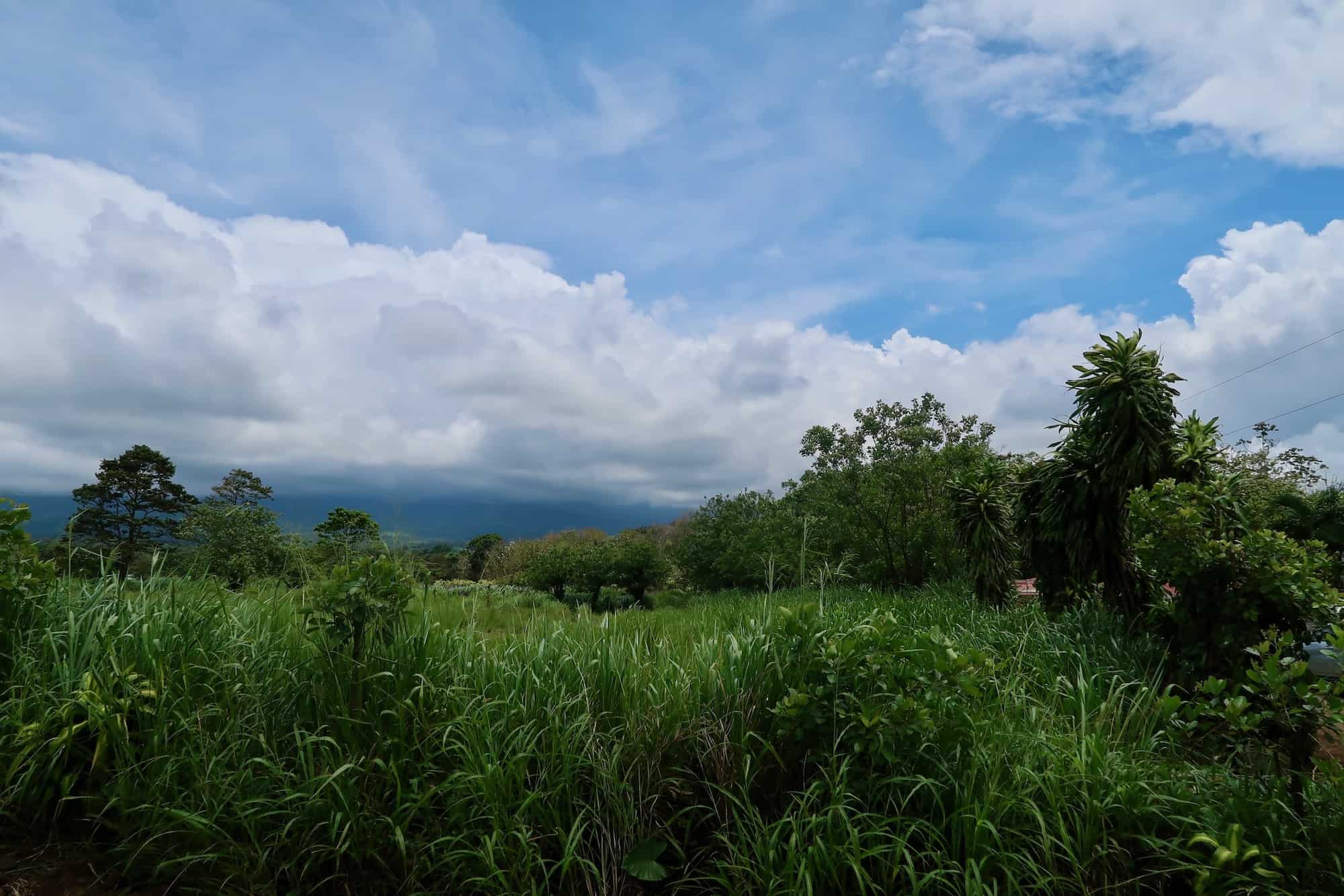
While disappointed that I couldn’t find anything there, before heading back to my car, I stopped to climb onto the earthen rises at the side of the road for a better view of the area. The tall, green crop fields went on for miles into the distance, eventually giving way to faded blue mountain silhouettes on the western horizon.

Finally back into the car, I had to retrace my path down the horrible road back to Highway 4. Up next were the archaeology sites of Las Mercedes and El Guayabo.
How to Get to Costa Rica’s Cutris Archaeology Site
GPS Coordinates: 10.40411, -84.2735

The Cutris Archaeological Site is located approximately 4 kilometers south of the major National Highway 4 in an area called Venecia de San Carlos in Alajuela Province. In order to reach the archaeology site, you need to drive this distance on an exceptionally rough, unpaved road that is littered with holes and sharp rocks.
This road is only used by locals who need to reach remote farming towns far from the main highway and by large trucks carrying produce. To get to the Cutris site without damaging your vehicle, a car with high clearance is needed.
At the time of my visit in 2021, the archaeology site was entirely inaccessible due to its location on private land in a reserve overseen by the National Museum of Costa Rica. Between the current status of the archaeology site and the driving condition required to reach the site, I would not recommend making the trip.
Should the situation change, this advice will be updated.
Fast Facts
Fast Facts
Name: Costa Rica’s Cutris Archaeology Site
Where: Venecia, Alajuela, Costa Rica
Location: 10.40411, -84.2735
Description: The Cutris .
Getting there: The Cutris Archaeology Site is located on private property several kilometers from the main paved road. 4-wheel private transportation is needed.
Cost: Not accessible to the public
Sources
- “Cutris .” Sitio Arqueológico, Cutris, Alajuela, San Carlos, Venecia, Costa Rica, origenes.museocostarica.go.cr/detalleBusqueda.aspx?id_sitio=7430.
- Guerrero, Juan V. “Informe De Inspección En Sitio Cutris (A-21 Ct) San Carlos, Alajuela.” Oregenes Base De Datos Dd Monumentos Arqueologicos, National Museum of Costa Rica, 11 Nov. 2016, origenes.museocostarica.go.cr/Files/Document/Informe%20de%20inspecci%C3%B3n-2.pdf.


